


The Contaminants extension for Leapfrog Works provides intuitive and robust geostatistical tools to create transparent and defensible estimates of contaminant mass and location in saturated and unsaturated zones.
Know your plume with the Contaminants extension
Accessible, best practise plume modelling for geoscientists and stakeholders within Leapfrog Works
Talk to an expertTry it todayBring contaminant data into 3D geological models
Streamline workflows
Integrate contamination models alongside your geological models to see the full picture.
Reduce uncertainty
Quickly model different hypotheses and test your assumptions around the contaminated zone. Apply different parameter inputs and instantly see how they affect the end results.
Understand variance within the models.
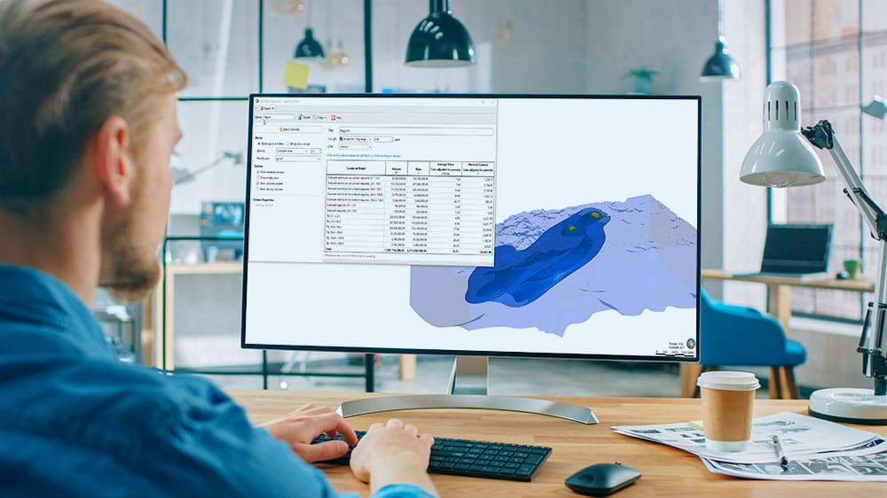
Calculate contaminant mass and volumes at different concentration thresholds.
Make advanced geostatistics easy
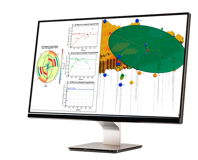
Use interactive controls and querying functions that make running geostatistics, including variography, intuitive to team members.
Onboard new users quickly with world-class support and training.

Try the Contaminants extension today.
Talk to usSee the Contaminants extension in action
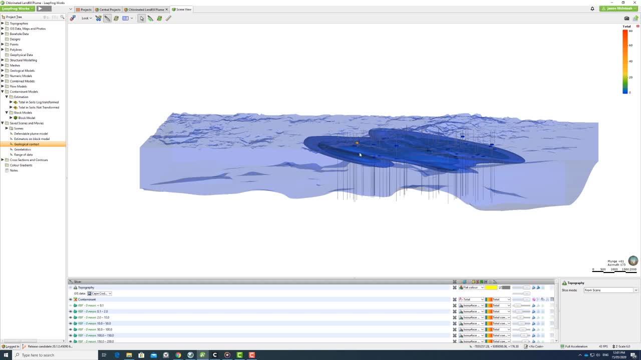
Integrate environmental data with geological data
The Contaminants extension for Leapfrog Works brings contaminant modelling into your geological models.

Apply kriging
Add standard geostatistical tools, like kriging, alongside enhanced variography and isosurfacing in your Leapfrog models.

Control variography
Create the best interpretation and validate the results in a 3D interactive environment. Variography results can be queried in a transparent easy-to-navigate interface.

Track your data
Produce plume models that evolve automatically as new data is added. Manage models and linked outputs for reporting, like cross-sections, 3D views, contaminant mass, and impacted soil volume calculations.

Ensure defensible estimates
The variogram and data that makes up the interpolant is transparent and auditable. Powerful interrogation tools reveal the data driving your decisions.

Calculate contaminant mass
Use block models to calculate contaminant mass and volumes at different concentration thresholds.

Create dynamic geological domains
Integrate your environmental plume model with your geological models using intuitive and robust geostatistics modelling tools.