search

The Airborne Quality Control extension for Oasis montaj allows you to design and plan airborne Geophysical surveys. In addition, you may perform industry-standard quality control on your data to protect your team’s time and investment in your project.

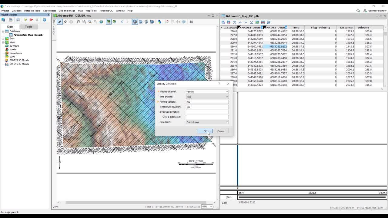
With this latest release, we have added new functionality and improved usability with the addition of Velocity Quality Control and custom quality control display and plotting options. These new additions allow you to increase your confidence in your airborne data and improve your team’s efficiency when communicating survey results.

Ready to start using Oasis montaj 9.10?

Download now

Free training and support

Grow your geoscience knowledge, connect with peers, and refresh your skills

Seequent Community

Discover new opportunities, connect with peers, and share insights and best practices with others in your field.

Visit Seequent Community

Learning Centre

Get started fast or upskill whilst working with our onboarding and advanced free eLearning courses.

Visit Seequent Learning Centre

Seequent Help

Find answers to your technical questions and get the most out of your product, with our in-depth product help information.

Visit Seequent Help