


Recently, members of the Seequent Civil and Environmental team, Matt Grove and Becky Bodger, attended the 7th Mine Action Technology Workshop in Basel, Switzerland. The event, hosted by the Geneva International Centre For Humanitarian Demining (GICHD), aimed to gather mine action experts, including national authorities, United Nations, international organisations, operators, manufacturers and other experts to discuss the use of innovation and technology when solving the problem of Landmines and Unexploded Ordnance (UXO).
Landmines and UXO are an issue that many countries face. In Laos, about one third of the land remains contaminated with UXO left behind from the Vietnam War, including about 80 million cluster munitions, which has caused over 20,000 deaths or injuries since the war finished (1). In Europe, over a century after the First World War began, thousands of unexploded bombs are still found on the former front lines. More than a billion shells were fired and as many as 30 percent failed to explode, many containing poison gas (2).
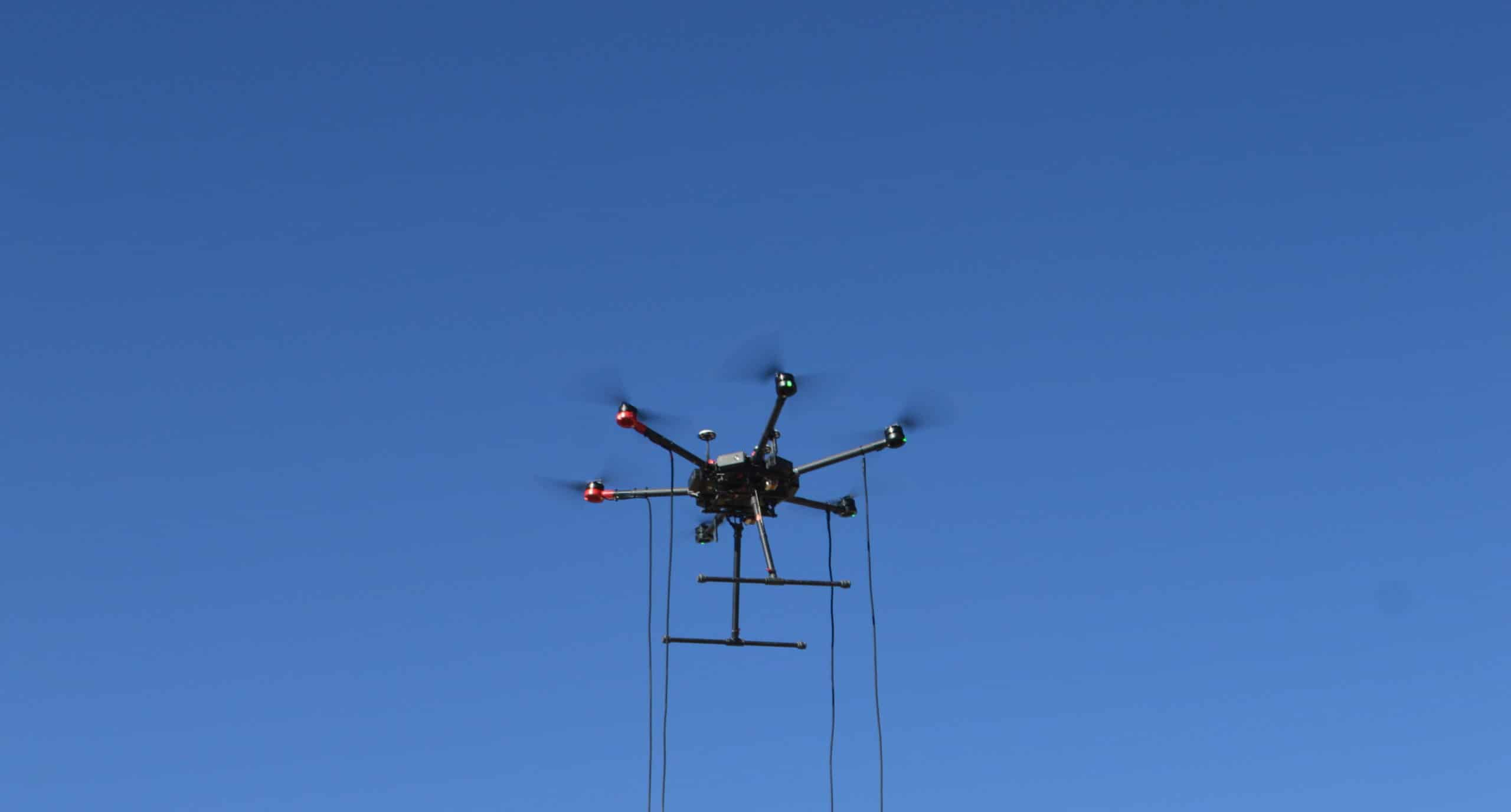
The workshop highlighted new and innovative solutions already being used to tackle challenges such as covering large and often difficult to navigate areas of land, safety, costs, accuracy, and classification. In particular, drones were the centerpiece of the workshop with new technologies making them lighter, more powerful, and more accessible. Drones can now fly for longer, cover more area, and carry larger pieces of surveying equipment.
One of the highlights, according to Becky, was the presentation by Mobile Geophysical Technologies (MGT) on their new penta-mag drone system. MGT has modified standard geophysical procedures (geomagnetics and electromagnetics) in such a way that they can be used on drones. With the advancements in drone technology coupled with state-of-the-art geophysical sensor systems, it is now possible to measure large areas (up to 100 km2) efficiently and fly projects on a dense measuring grid (1 m line spacing) at extremely low altitudes (1 m) above ground (3).
Now, drones are also being equipped with machine learning technology that can recognise patterns or features, and plot out where it detects repetition. This technology not only cuts down analysis time for operators, it also supports planning for site remediation by predicting the tools and labour are needed to complete the job. This would be particularly beneficial in large areas such as Chad, which is heavily contaminated with landmines and other unexploded bombs from conflict with Libya.
It is well known that UXO is a humanitarian crisis for many countries, causing major obstacles for local development and daily risk of death or injury. Speaking with non-profit organisations like MAG and The Halo Trust at the workshop, shows that there are many inspiring people giving their time to help with the development of new methods for clearing UXO.
It was evident that one of the key themes and challenges from the workshop was the need for a way to combine and visualise data. In UXO, no one method works alone. Some methods are good in deserts, while others work best in forests or urban environments. Operators need to combine technologies and different types of data together to give the best picture. This is where software plays an important role. Seequent’s solution for land and marine UXO surveys, Oasis montaj, provides purpose-built tools to process large volumes of geophysical data. This solution allows precise positioning of single sensors or sensor arrays, navigation corrections when working in marine environments, as well as the application of instrument corrections and filters to remove unwanted noise or signal from your data. With Seequent’s technology you can perform data quality control checks that give confidence in the accuracy of target locations and the overall quality of the data.
- http://legaciesofwar.org/about-laos/leftover-unexploded-ordnances-uxo/
- https://www.bbc.com/news/av/world-europe-26663643/behind-the-scenes-with-belgium-s-bomb-disposal-unit
- http://www.mgt-geo.com/technology.htm
- https://www.maginternational.org/what-we-do/where-we-work/chad/