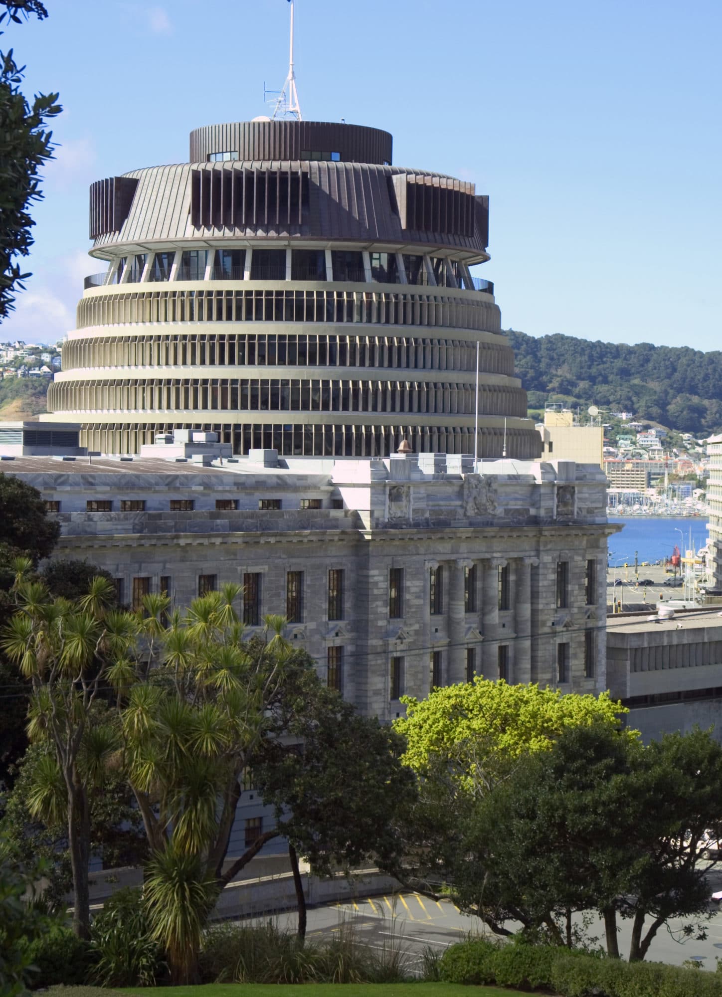
Wellington, New Zealand not only holds significance as the capital city – but it also houses important infrastructure such as New Zealand Parliament, Te Papa – New Zealand’s national museum and key transport routes between the North and South Islands.
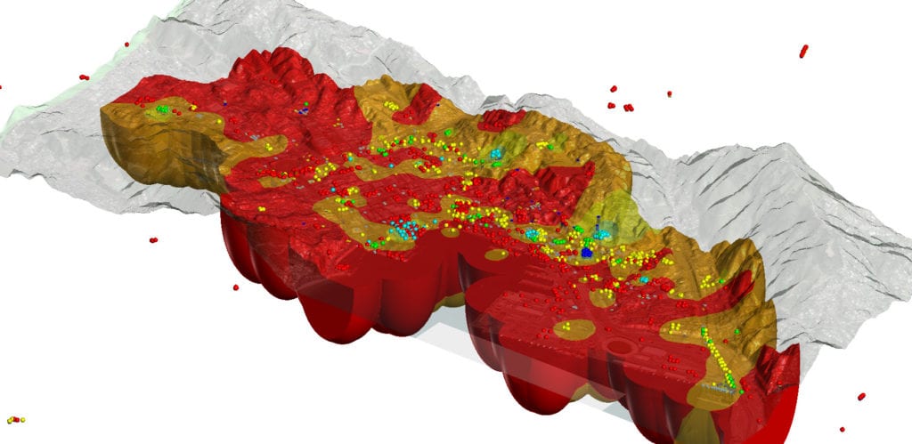
Like many parts of New Zealand, the Wellington region is subject to earthquakes and has many active faults which present a major earthquake hazard. Understanding the seismic risk of New Zealand’s capital city requires an in-depth understanding of the complex geology and structures that lie beneath. Only in this way can future engineering decisions be made that help limit impact from future earthquakes. A multi-disciplinary team of specialists have collaborated to build a robust 3D subsurface model of the Wellington region using Seequent’s Leapfrog Works’ dynamic 3D modelling solution. The model will be used to inform future engineering and building decisions.
The Project
GNS Science: Te Pū Ao, The University of Auckland and the Natural Hazards Research Platform have collaborated to map the subsurface of the Wellington Region and to create a 3D subsurface model using Leapfrog. A paper explaining the full project outcome is to be published by Anna Kaiser and others, of GNS Science and The University of Auckland, the findings of which will be valuable for seismic studies, city planning and building construction.
The project has been ongoing for several years and aims to update the first 3D subsurface model of the Wellington Region from 2010 (created in Leapfrog by then masters student Stephen Semmens) with the latest geological data and understanding. The project was made possible due to a research grant from the Natural Hazards Research Platform following the Kaikōura earthquakes.
Multiple disciplines are represented in the project including seismologists, engineering geologists, geophysicists and geologists. The project has benefited from advances in Leapfrog software and to-date there have been 22 model versions accruing some 81GB of data. The iterative nature of the project has been a key feature, requiring the regular updating of the 3D subsurface model. The ability to readily share key model views with the multi-disciplinary team has also been an essential component to ensure fast, clear communication and interpretation.
Leapfrog Works’ fast and dynamic 3D subsurface modelling solution specifically designed for the Civil Engineering and Environmental industries allows for the faster creation and updating of 3D subsurface models, while the highly visual 3D models improve understanding of geological risks, which can be more accurately communicated through sharing and collaboration tools.
“The Leapfrog 3D subsurface model really helped the multi-disciplinary team to communicate as it created an interactive environment, contributing to conversation and collaboration”
Matthew Hill, Geologist, GNS Science
The Setting
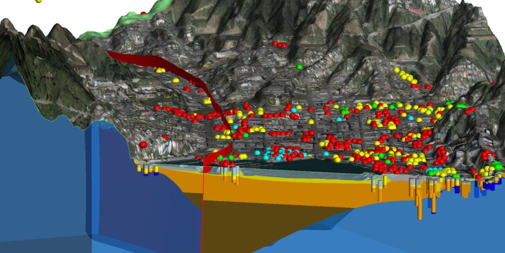
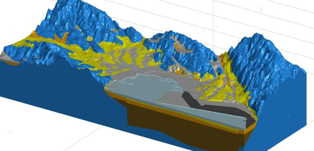
Understanding the seismic risk in Wellington requires an understanding of the geology and structures that underlie the city. The Leapfrog model characterises five different geological units deposited above the basement rocks below Wellington that are distinguished by their geotechnical and geophysical properties. The Wellington sedimentary basin had a critical influence on ground motions and damage patterns during the 2016 Mw 7.8 Kaikōura earthquake, which caused significant damage to numerous mid-rise structures, due to the presence of soils in the sedimentary basin that amplified shaking. Knowledge of the 3D basin subsurface and spatial variation of geotechnical properties is crucial to guide robust engineering design practices that take into account site-specific ground shaking characteristics.
The Response
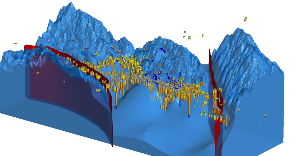
A wealth of new data was incorporated to improve the 3D model of the basin subsurface and update maps of key geotechnical properties. This varied surface and subsurface data included new geophysical measurements, new Light Detection and Ranging (LiDAR) surveys and an updated borehole database. The project also benefitted from access to the New Zealand Geotechnical Database, (NZGD), a newly established national repository for new and existing geotechnical information. The model improves on the shape and structure of the Thorndon and Te Aro basins using the new borehole data (particularly from those holes that reach basement rock) and from the use of the Wellington Fault and the newly defined Aotea Fault as block boundaries within the 3D subsurface model. Leapfrog was able to readily incorporate all of these varied data types to produce a robust model with a high degree of corroboration from the varied data sources.
Data Rich Project
The project made good use of data from the NZGD, Matthew explains, “The NZGD database has been invaluable for the project and has brought together a variety of public and private data which has contributed to a truly data rich project. We’ve been able to build on previous research and add additional data to the model as it has come to light. Leapfrog has been particularly helpful as it can readily incorporate new information and allows us to model iteratively.”
A key feature of Leapfrog is that new information can be readily incorporated without the need to recreate the model from scratch, saving considerable time and money. Using this dynamic updating feature the multi-disciplinary team was able to work with live borehole data, Matthew continues, “The team were able to effectively update and rerun and recalculate the whole of the model as the project progressed.”
Using ‘View’, Leapfrog’s web-based solution for viewing and interacting with Leapfrog models, all stakeholders were able to easily access updates to key model views. “Everyone can open the model on their own computer and review prior to meetings or discussions. This really helps speed up communication and understanding in a multi-disciplinary study like this.”
Discovery of the Aotea Fault
A key milestone in the project was the discovery by Crown Research Institute, The National Institute of Water and Atmospheric Research, (NIWA), that the Aotea Fault, previously considered to be inactive, was actually an active fault. Matthew continues, “The identification of the new active fault by NIWA made a big difference. The discovery revealed that along with the Wellington Fault, the basin is bound by faults on both sides. Using Leapfrog we were able to easily add and activate the fault in the model, which was particularly useful as we didn’t have a lot of borehole data in some areas near the fault. But the borehole data what we did have and the geophysical data really correlated well with the newly modelled fault block.”
Understanding Confidence
To understand confidence in the geological model and create an uncertainty model, a modelling feedback process was utilised. Matthew, explains, “We utilised recently collected geophysical measurements to test and improve the geological model through a modelling feedback process and to understand confidence. An uncertainty model was created using a process that subjectively weighted important properties in the 3D workspace, including borehole data quality, distance from surface and subsurface observations, and basin depth. By using known shear wave velocity ranges for sediments in Wellington we were able to derive a 3D velocity model for the region.” The model has also been used to create other data sets such as the calculated fundamental site period, depth to basement rock and the thickness of fill. These are all important attributes that need to be considered for seismic studies, city planning and building construction.
Outcome
With the newly improved 3D model, engineers and seismologists are able to assess and review the model and decide on a site class-map that Council’s will refer to regarding engineering requirements. Having this up to date and vastly improved 3D geological model will help to guide robust engineering design practices that take into account site-specific ground shaking characteristics. Ultimately, the model will help Councils to plan and advise on building requirements to ensure that the risk of damage from future earthquakes is mitigated.
“The team were able to effectively update and rerun and recalculate the whole of the model as the project progressed.”
Matthew Hill, Geologist, GNS Science
Anna concludes, “By combining information from the 3D model and geophysical measurements, we can update maps of central Wellington site period and site subsoil classification. These maps are critical for the engineering community and local and central government, enabling them to guide and evaluate current design practices according to New Zealand’s engineering code standards.
They also allow improved assessment of damage patterns recently observed in Wellington. Furthermore, the updated 3D basin model is a critical component needed for simulation of shaking during both past and future earthquake scenarios. This ongoing research can be used to better understand and mitigate the impacts of complex site and basin amplification effects in Wellington.”
Seequent’s Civil and Environmental Product Manager, Pat McLarin, comments, “We’re pleased Leapfrog’s dynamic 3D modelling has been pivotal in this significant research project to bring together the combined efforts from a broad cross disciplinary team into a single robust 3D subsurface model. Leapfrog provides an unrivalled level of accuracy and efficiency in understanding ground conditions. As an organisation that’s been directly impacted by earthquakes in the past, faultit’s satisfying that our solutions are contributing to better understanding and mitigation of their impact on others in the future.”