


Drones: The new normal in environmental geophysics
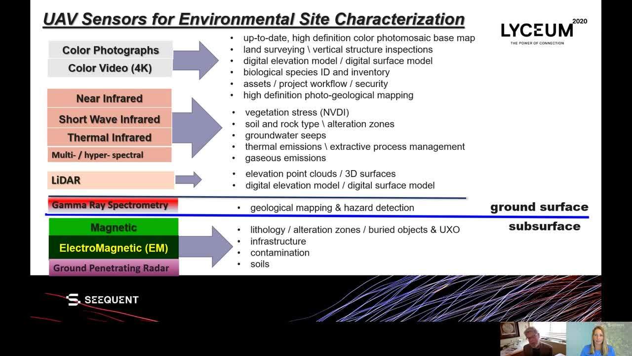
Since 2018, the utilization of remotely piloted small unmanned aerial vehicles (UAVs), commonly referred to as “drones”, has exploded in the environmental geosciences as photogrammetry and LiDAR mapping realized the promise of high definition data at a low cost per data point. Drone enabled magnetometry began to flourish which has led to the development of new drone enabled ground penetrating radar and electromagnetic induction (EMI) systems as well as the evolution of gamma ray spectrometers. Join Lorraine Godwin – Seequent’s Director, Near Surface as she explores this topic with Ronald.
Overview
Speakers
Ronald Bell
Senior geoDRONEologist,International Geophysical Services, LLC
Duration
21 min
See more on demand videos
VideosFind out more about Seequent's environmental solutions
Learn moreVideo Transcript
transcript here