search

Comparta información visual con Geosoft Viewer

Visualice y comparta al instante datos de geociencia sin costo.

Descargar

Comparta modelos de geociencia con quienes quiera

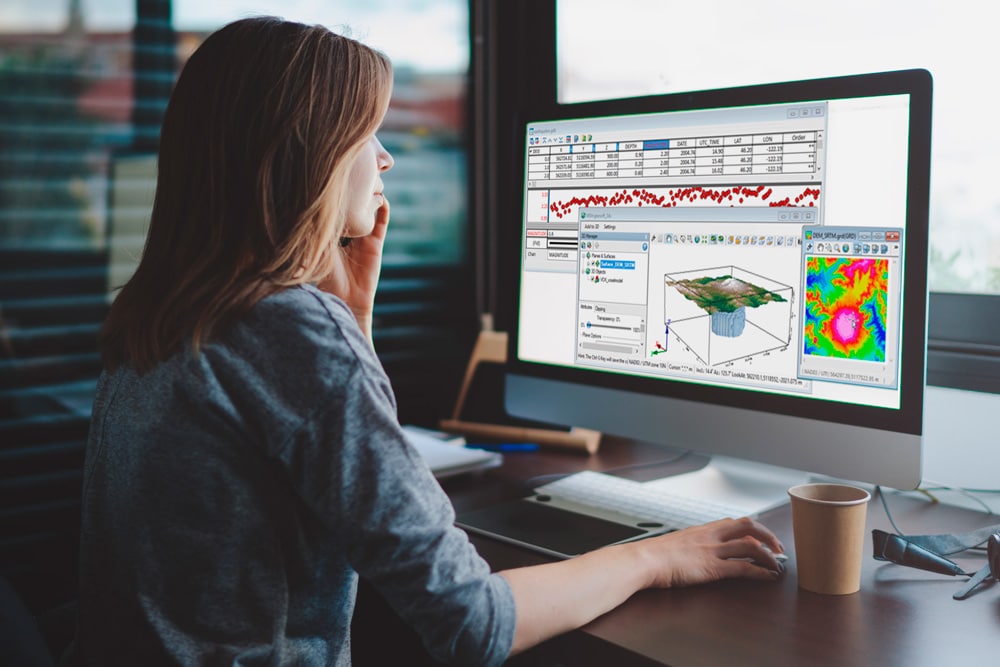
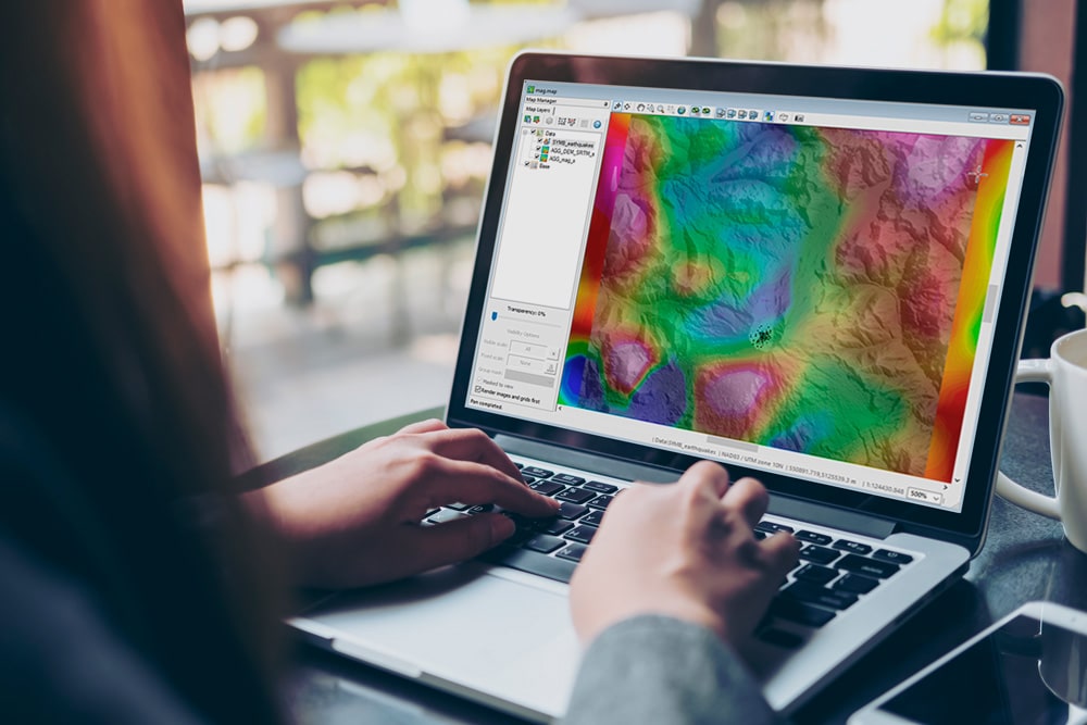
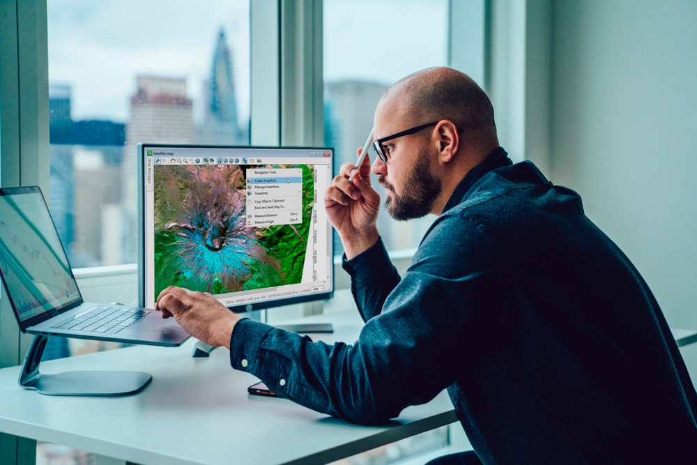
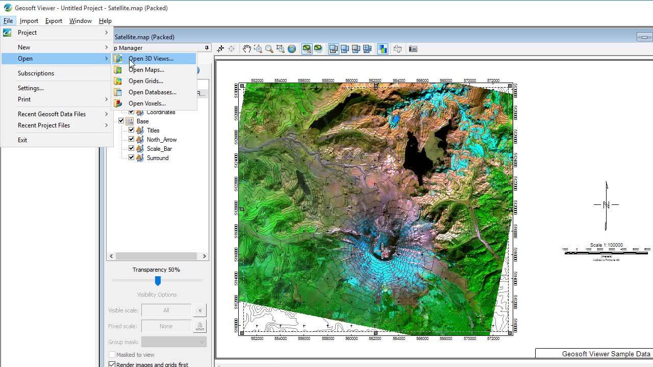
Visualisations give meaning to your data, making insights accessible. Share data with other teams and with non-technical stakeholders to help them make informed decisions. Import a variety of geoscience and geospatial file formats and integrate your data in 3D and maps – then share them with others.

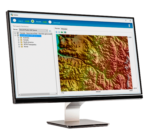
The Geosoft Viewer desktop app is free to download by anyone, even if they don’t have an Oasis montaj or Target license.

Visualice datos de geociencia con facilidad

Abra formatos comunes de datos de geociencia y visualícelos en perfiles, mapas y vistas 3D personalizados. Geosoft Viewer es compatible con muchos formatos de archivo estándar de la industria, como Geosoft Maps (.map), Grids (.grd), Databases (.gdb), Voxels (.voxel), y 3D View (.3dv).

Visualizar, integrar y superponer

View your data in profiles, maps, and in 3D models to gain a deeper understanding of the data and your project area.

Apply raster colours and shading to customise appearance and emphasise details. Compare multiple datasets side-by-side or adjust the transparency of your data layers and overlay them to identify the subtle relationships between the different datasets.

Convertir, exportar y compartir

Create shareable products to communicate your results with your colleagues and clients. Email or print your maps and 3D views. Quickly export them as images or PDF files to include in reports and presentations.

Share the Geosoft Viewer with colleagues and stakeholders to connect your whole team, allowing anyone to view your geoscience data as maps, databases, or interactive 3D models.

Buscar datos públicos

Use the built-in Seeker search engine to access Geosoft’s Geoscience Data Service. Quickly find and download public geoscience and topographic data for your project area. 

Download data from multiple datasets and choose your preferred file formats including: SRTM topography, regional gravity and magnetic survey grids, coastline, and political and cultural boundaries in WMS format. 

Contemple el poder de Geosoft Viewer

Qué puede hacer con Geosoft Viewer

Crear cuadrículas e imágenes

Crear cuadrículas e imágenes

  • View a number of grid formats including: Geosoft, ER Mapper, and USGS grid files 
  • Modify the colour, stretch, and shading 
  • Convert grids and images to a variety of supported formats 

Obtener vistas 3D

Open and create Oasis montaj 3D views

  • Display relief surfaces, grids and images, symbols from databases, Geosoft and Vector Voxels, Geosoft strings and surfaces
  • Import AutoCAD 3D, DXF, MapInfo TAB, ArcGIS Shape and Layer files, Microstation DGN, Maxwell Plate, and Leapfrog model files
  • Adjust colours, clipping, and transparency of layers
  • Create snapshots and share packed 3D Views
  • Export to 3D PDFs
Ver mapas de Geosoft

Ver mapas de Geosoft

  • Display grids and images, modify the colour stretch and shading
  • Import a variety of image formats including: Bitmap, Jpeg, TIFF, and GeoTIFF

Ajustar la transparencia de las capas

  • Import AutoCAD DXF, MapInfo TAB, ArcGIS Shape, and Layer files
  • Export maps to PDF and various image formats for reports
  • Print maps to Windows compatible printers and plotters
  • Create snapshots and share packed Oasis montaj maps
Visualizar bases de datos y archivos XYZ

Visualizar bases de datos y archivos XYZ

  • Open Geosoft Database (.gdb) files
  • Import Geosoft XYZ files (.xyz), Geosoft Binary Files, and ASEG files (ESF and GDF)
  • View channel statistics, display database profiles
  • Create profile maps to export or print
  • Export data from a Geosoft database (.gdb) to XYZ, CSV, GBN, and ASEG-GDF
Buscar datos públicos

Buscar datos públicos

Utilice Seeker para acceder al servicio de datos de geociencia de Geosoft (con tecnología de DAP). Busque y descargue al instante datos públicos topográficos y de geociencia para el área de su proyecto.

Descubra Geosoft Viewer

Descargar