


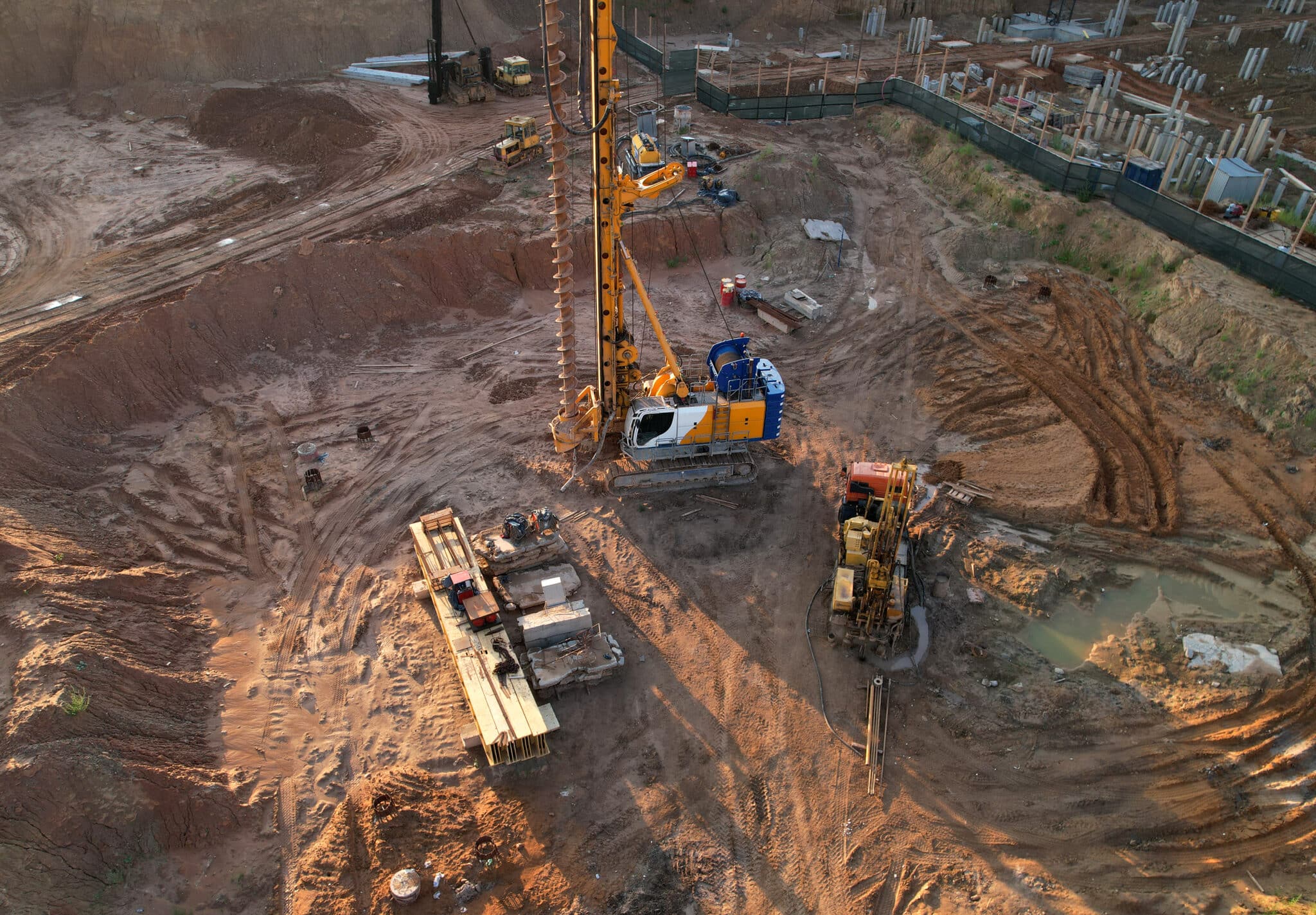
Geotechnical data volumes have increased exponentially in recent years.
And as technology improves, enabling better and deeper insights, the amount of data being generated is becoming even bigger.
So, companies that deal with geotechnical data are facing bigger challenges in how to manage it. As projects grow in size and complexity, so does the amount of data. Teams are also becoming larger and are spread across multiple locations. The desktop solutions that have historically been used to share and analyse this data are becoming slower and unwieldy.
Arcadis is the world’s leading company delivering sustainable design, engineering, and consultancy solutions for natural and built assets. With more than 36,000 people in over 70 countries, it needed to find a new solution for collecting, sharing, and analysing the vast amounts of geological data it deals with.
Let’s take a look at why Arcadis chose to move to the OpenGround cloud-based geotechnical information management platform and how doing so has revolutionised its operations.
A need for speed
Previously, Arcadis had used a desktop interface with data stored in a database on a local server in one of its offices. With teams in multiple offices accessing the data via VPN, including locations as far away as Mumbai and Bangalore, this was becoming problematic.
Anyone that wasn’t in the same office as the server suffered lags in accessing the data, and for those in India, it could take several minutes just to apply a simple filter or sort on a data set.
As well as speed issues, scaling up storage as the data grew was not straightforward. Hardware upgrades and new versions of the software had to go through procurement and IT approvals, a process which sometimes took several weeks. This led to delays in expanding the storage and getting access to fixes and new features in the latest versions.
Matt Gamlin, Principal Geo Science Data Consultant at Arcadis, knew that these problems would only become more painful as the company continued to grow and take on larger projects. So he turned to the OpenGround platform to streamline the management of geological data and allow for the efficient scaling of operations.
Improving usability, data quality, and efficiency
To show that OpenGround was the right move for Arcadis, Matt identified several benefits it would bring to the business:
- Improved usability at multiple locations — both internal and external team members would be able to smoothly access data from anywhere with an internet connection.
- Improved data quality and efficiency along the supply chain — no more lengthy delays in validating and tagging data before exporting it to partners.
- Quicker software updates that didn’t need to wait for resources from the internal IT team to process.
- An expanded software environment thanks to all the direct plug-ins for other geotechnical data tools available in OpenGround.
- Efficient licence management and scalability to easily expand as the team and the amount of data grow.
To validate this, Arcadis first implemented OpenGround for its work on HS2, a major high speed rail project in the UK.
OpenGround in action
Arcadis’ Principal Geotechnical Engineer, Alex Beever, explains that the HS2 project was an ideal test for the new solution as in the controlled database alone there are over 7,000 GI locations and over 5 million individual records. There is also the data management challenge of an extensive ongoing GI with regular transmission of data that needs to be shared with the wider team as quickly as possible. Managing this large data set and sharing it with joint venture partners would have been very difficult without OpenGround.
He goes on to detail how Arcadis took advantage of all the software that can be seamlessly integrated with OpenGround.
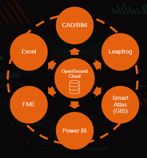
Rueda de integración de datos OpenGround de Arcadis
First, his team now uses Feature Manipulation Engine (FME) to streamline the input of data into OpenGround. It has a graphical interface with which they created automated data workflows to handle complex data integration tasks such as merging data from multiple sources, reprojecting coordinate systems, cleaning data, and enriching data sets with additional attributes. The team have built processes to automate the checking of the data that comes in once a month, saving them weeks of time per month and importantly, keeping the data clean and establishing a single source of truth.
Ejemplo de un banco de trabajo de FME que valida los datos de AGS frente a un conjunto de reglas y genera un informe de la calidad de los datos
Once the data is cleaned they use the Civil 3D extension in OpenGround to build templates and design interpretation tools. This allows designers to review everything within OpenGround and provide feedback and request changes so they can continue modelling their geological horizons in the same software.
They also use Power BI, a data analytics and visualisation platform that provides a suite of tools that enable users to analyse data, create reports, and share results via interactive dashboards across teams and organisations. Power BI can connect to a wide range of data sources, including cloud services, making it easy to connect to OpenGround via the API. Arcadis uses this to build dashboards to present a multiple of common data sets in one report rather than forcing users to use multiple reports in Excel.
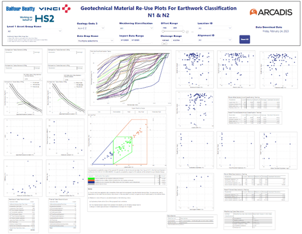
Ejemplo de tablero de PowerBI conectado a OpenGround
Arcadis usa Leapfrog para permitir la integración de las fuentes de datos, como descripciones geológicas del campo, datos geofísicos, resultados de muestreos ambientales y pruebas in situ. Además de permitir visualizar conjuntos de datos GIS, CAD y BIM, esto ayuda a los usuarios a hacer un modelo del suelo de su sitio y, así, comprender mejor el entorno del subsuelo. Arcadis utiliza esto para presentar a los socios una interpretación de la geología y modelos de diseño e información adicional, como el contenido de humedad y azufre o los niveles de agua subterránea. Además, con la dirección directa a Leapfrog, Arcadis puede actualizar fácilmente los modelos con un trabajo relativamente limitado.
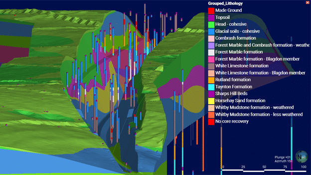
Datos de OpenGround en acción dentro de Leapfrog Works
Finally, Arcadis’ in house web-GIS application Smart Atlas, is utilised to bring together all of the outputs in one user friendly, easy to access platform. With both 3D and 2D datasets included, all users’ requirements are catered for whether they need to visualise the 3D geological model in context with existing buildings and proposed foundations or need to produce report ready 2D plans.
Driving forward with a single source of truth
By having these seamless integrations of other products, OpenGround has allowed Arcadis to have a single source of truth for ground data on its projects. This means the company can provide access to internal and external team members, wherever they are in the world. It’s also enabled the wider team to develop their skills in digital workflows by using products such as Power BI and FME. Many of the workflows they’ve built will be able to be reused on future projects both large and small.
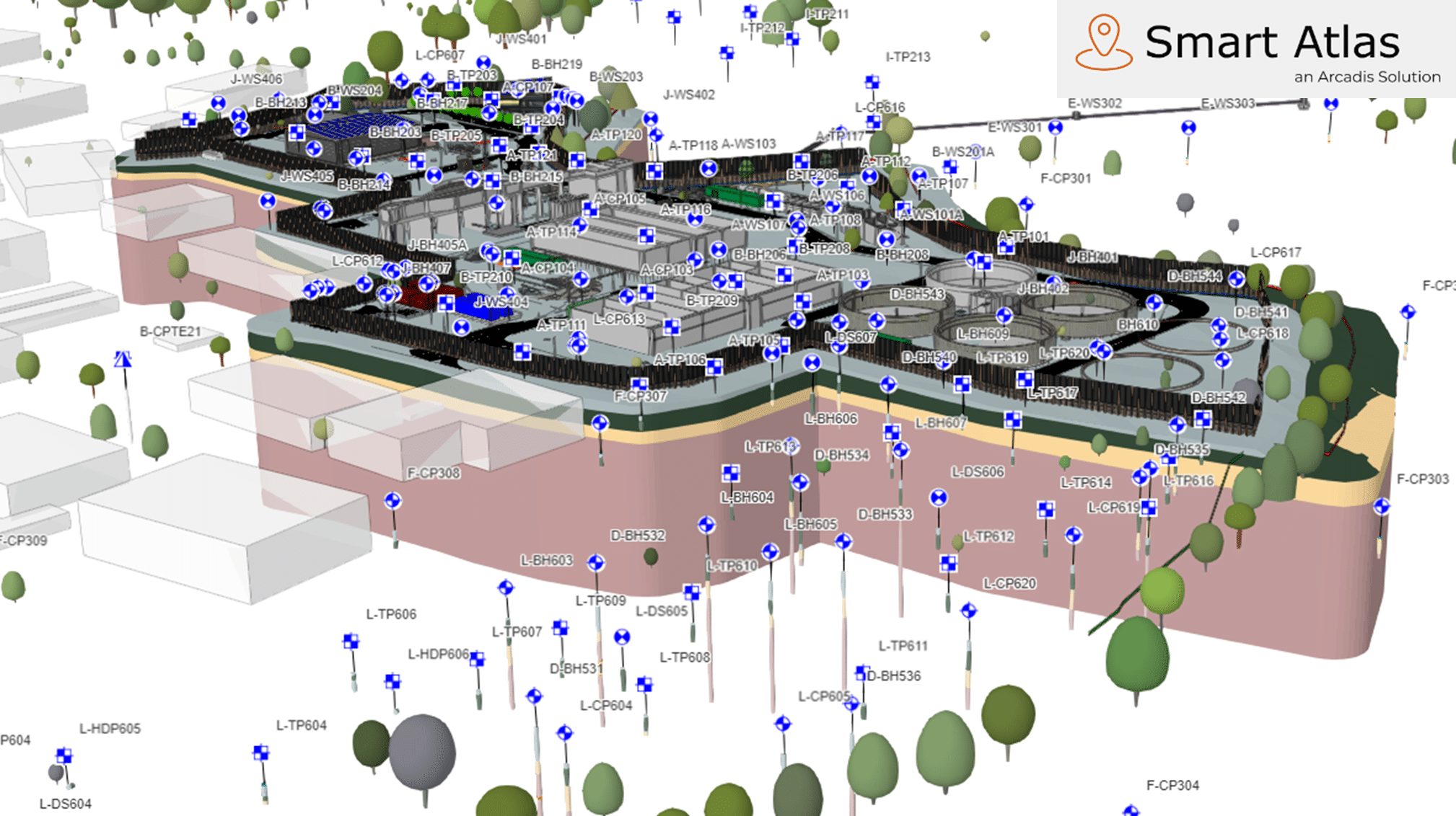
Datos de OpenGround Data, el modelo Leapfrog y datos de BIM en contexto con la geografía que los rodea en la aplicación web GIS personalizada de Arcadis, Smart Atlas.
Want to discover more about Arcadis transition to OpenGround? Watch our webinar where Matt and Alex explain in their own words the benefits it has brought them. As well as more detail on the HS2 project it also covers their use of OpenGround on a new sewage treatment work site as part of Guildford’s Weyside Urban Village — a regeneration project delivering new homes and community facilities on a brownfield site.