search

Модуль геофизики

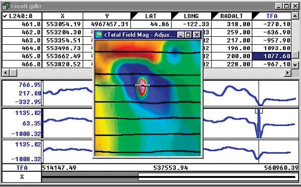
The montaj Geophysics™ extension provides a range of filters and statistical tools for working with large volume geophysical data.

Spatial 1D Filters enable field geophysicists to process data by applying a variety of space domain filters (linear and non-linear).

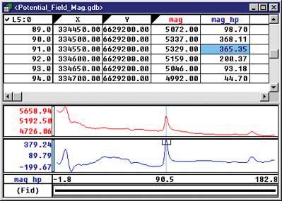
The 1D FFT Filter enables you to apply a variety of Fourier domain filters to onedimensional (line) potential field and other data.

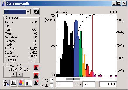
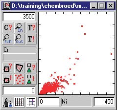
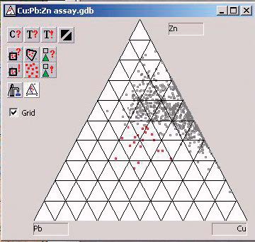
A variety of geostatistical tools provide the ability for summary and advanced statistics, including histogram, scatter and triplot analysis, and the ability to subset data based on code or map group classification.

Use montaj Geophysics to:

  • Smooth data, with or without non-linear filtering, using spatial one dimensional filters
  • Apply convolution filters, including Difference, Fraser, Laplace, Low-pass, Band-pass, High-pass, and User- Defined
  • Enhance the shorter wavelength features in the data using one dimensional Fast Fourier Filters (FFT). These include regional filters, upward/downward continuations and vertical and horizontal derivatives
  • Apply Lag Correction to a channel of data by shifting the start fiducial by a specified lag amount
  • Apply Heading Correction to data for a systematic shift (in the data) that is a function of the direction of travel for a survey line
  • Apply Magnetic base station correction to a magnetic channel
  • Perform profile-based processing for interpretation and modeling purposes
  • Perform multivariate analysis using histogram, scatter and triplot statistical analysis tools
  • Select and subset data interactively from maps based on text codes, regions or map groups.

Spatial 1D Filters

Smooth data, with or without nonlinear filtering, using spatial one dimensional filters. The montaj Geophysics extension includes these 1D filters:

  • High-pass filter applies a high-pass (sharpening) filter to a channel
  • Low-pass filter applies a low-pass (smoothing) filter to a channel
  • Bandpass filter applies a filter that removes features longer than the long wavelength cutoff and shorter than the short-wavelength cutoff
  • Convolution filter applies space-domain averaging filter to a channel. The filter can be defined in a filter file or in a comma delimited string
  • Difference filter calculates differences between values in a channel. The common fourth difference can be calculated by specifying four differences, which is useful for identifying noise,
  • Polynomial filter calculates n’th (maximum nine) order trend of a data channel by (least square) best-fit polynomial. The trend is then evaluated and placed in a new channel. An optional residual channel (input trend) may also be created
  • B-Spline filter calculates a B-Spline interpolation of data in a channel. A B-Spline allows you to control the smoothness of the spline and the tension applied to the ends of the spline
  • Linear Regression filter fits a least-square linear regression to a set of marked data in a channel and reports the slope and intercept.

1D Non-Linear Filters

Use 1D Non-Linear Filters to remove very short wavelength, but high amplitude features from data. It is often thought of as a noise spike-rejection filter, but it can also be effective for removing short wavelength geological features, such as signal from surficial features.

The 1D Non-Linear Filter is used to locate and remove data that is recognized as noise. The algorithm is ‘nonlinear’ because it looks at each data point and decides if that data is noise or a valid signal. If the point is noise, it is simply removed and replaced by an estimate based on surrounding data points. Parts of the data that are not  considered noise are not modified at all.

Fourier Filters can be used to:

  • Perform profile-based processing for interpretation and modeling purposes
  • Rapidly apply filters to one or more lines of data
  • Interactively select filtering parameters, display power spectra and identify optimal filters for processing and interpretation
  • Automatically sample to distance or optionally to fiducials.

1D-FFT Filters

Apply a variety of Fourier domain filters to one-dimensional (line) potential field and other data to effectively processe and interpret your data.

By transforming data to Fourier domain (through FFT), the data can be dealt with as a function of wavenumber, or wavelength. In this form, there are a number of data manipulations that can be applied to enhance information that is of interest, and /or remove information that is not of interest, and/or transform the data.

One dimensional Fast Fourier Filters include:

Sharpening filters that enhance the shorter wavelength features in the data. These include high-pass filters, downward continuations and vertical and horizontal derivatives. Such filters are normally used to enhance information from shallow geologic features.

Smoothing filters that enhance longer wavelength features in the data, normally by removing or attenuating the shorter wavelengths features. These include low-pass filters, upward continuations and integrations. Smoothing
filters are normally used to remove short-wavelength noise in the data or to remove the effects of shallow geologic features.

Geophysical transformations that convert data from one physical form to another. These include reduction to the pole for magnetic data and the calculation of apparent magnetic susceptibility or apparent density.

Lag, Heading and Base Station Corrections

Apply lag, heading, sensor offset, and base station corrections to control the quality of your survey data. Correction routines include applying a:

  • Lag correction to a channel of data by shifting the start fiducial by a specified lag amount
  • Heading correction to data for a systematic shift (in the data) that is a function of the direction of travel for a survey line
  • Magnetic base station correction to a magnetic channel

Geostatistical Analysis

The montaj Geophysics extension provides a range of statistical tools for working with high volume geophysical data including: summary and advanced statistics; histogram, scatter and triplot analysis tools and the ability to subset data based on code or map group classification.
The extension’s geostatistical functions enable you to
perform the following tasks:

  • Summary and advanced statistics
  • Create mask channel
  • Histogram analysis
  • Scatter analysis
  • Triplot analysis
  • Data classification based on region or map group
  • Create a database subset

Key Functionality

  • Spatial 1D filters and 1D Non-linear filters
  • 1D FFT filters
  • Lag, Heading and Base Station Corrections
  • Geostatistical analysis functions, including Histogram, Scatter, Triplot and Probability analysis

*The montaj Geophysics extension requires Geosoft’s Oasis montaj.

See all Oasis montaj extentions

Transform geophysics, geology, GIS, and geochemistry data – all in one place.

View Extensions