


How effective workflows can aid geophysical exploration, and the challenges they should address.
Geophysics plays a vital role in mineral exploration. It allows large areas of the subsurface to be imaged in a cost-effective and non-intrusive way. Geological features and associated mineral systems can be mapped quickly with reduced risk. This first look into the Earth can highlight areas of interest that can direct and focus expensive drilling campaigns and geological mapping, saving time, effort and money. It can be incredibly valuable.
However, geophysical exploration involves acquiring, processing and interpreting a wide variety of data collected using many different techniques, at different times and on different scales. Geophysical data often passes through a number of contractors and consultants before reaching the client.
While geophysical exploration can improve the chance of discovery and help target a deposit with precision, it requires an effective workflow to bring all these data and people together.
Where an effective workflow can focus its benefits
Data collection is often outsourced to geophysical contractors who specialise in a particular branch of geophysics. Several contractors and several geophysical consultants, doing QA/QC, might be involved. In addition, a mix of software could be used depending on company preference and budget. File types and formats might not be consistent, making integration more challenging.
For field-based geophysics teams, the daily influx of data, coupled with a rostered workforce can make it difficult to maintain workflow consistency. Data is at risk of becoming siloed with versions poorly tracked and updates lost. Projects need daily and weekly back-ups, often on hard drives that can get lost or corrupt and need suitable secure storage, sometimes for many years.
Contractors, consultants and clients are often spread across different locations, different time zones or in remote areas with poor internet and mobile reception. This can break down communication.
The importance of a transparent, accessible, single source of truth
Geophysical data is typically delivered in phases throughout a project: raw, preliminary and final. This keeps the client up to date with progress. But, at each stage, it is important that the client understands what could change and how much confidence to place in the data they receive. Processing transparency prevents incorrect interpretation of uncorrected anomalies, which could be a costly mistake. Geological input, particularly in the latter stages of processing and modelling, will help constrain the geophysical interpretation. This can unveil or better define targets of interest.
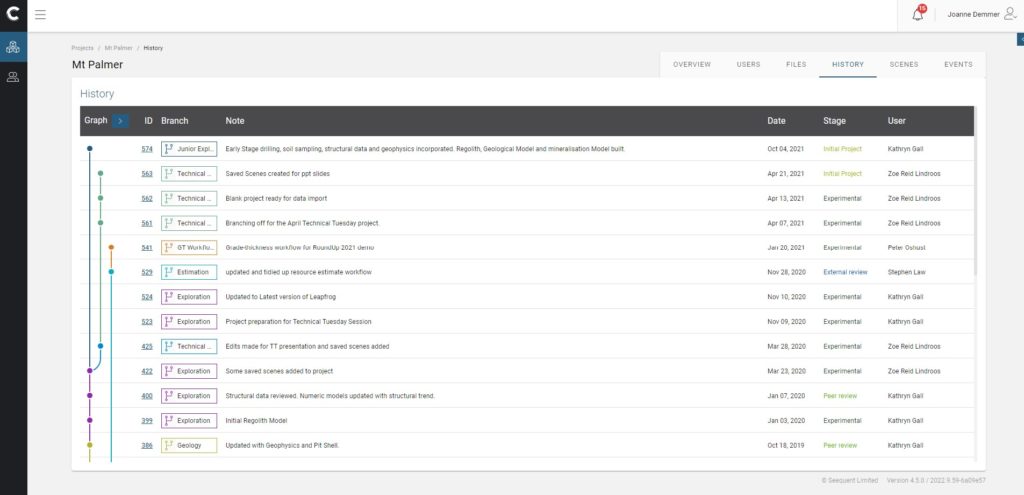
Exploration is an iterative process. Teams need to collaborate. Data needs to be shared. Seequent Central brings multidisciplinary teams and data together in one cloud based auditable environment. This enables collaboration around a shared single source of truth, which increases the chance of exploration success.