Jamin Greenbaum’s first experience in Antarctica was one he’ll always remember.
“We were doing a ground-based geophysical survey using snowmobiles,” he said. “There were four of us driving around 12 hours a day, towing long wires acting as radar antennas. We were sleeping in tents and cooking for ourselves. I ate a lot of beef jerky. There were some equipment problems we had to figure out at night and we were hundreds of miles from the next outpost. Of course, it was pretty cold too.”
Jamin continued, “It was great, super extreme. It was totally the adventure I wanted.”
A majority of Jamin’s research has focused on the Totten Glacier in the east, which contains the potential to increase sea level by at least 3.5 metres. To put that in context, a one-metre rise in global sea level would affect at least 145 million people around the world.
Jamin is an explorer at heart
For nearly 15 years, he was focused on space exploration through his work as an aerospace engineer. But in the last 12 years he’s turned his attention closer to home – and has been conducting geophysical research on Earth’s coldest continent, Antarctica. Now Jamin is a veteran of 12 Antarctica expeditions and three to Greenland, and he’s a postdoctoral researcher at the University of Texas Institute for Geophysics (UTIG).
“What motivates me is understanding vulnerabilities to large scale retreat of ice sheets, to better predict global sea level rise,” Jamin said.
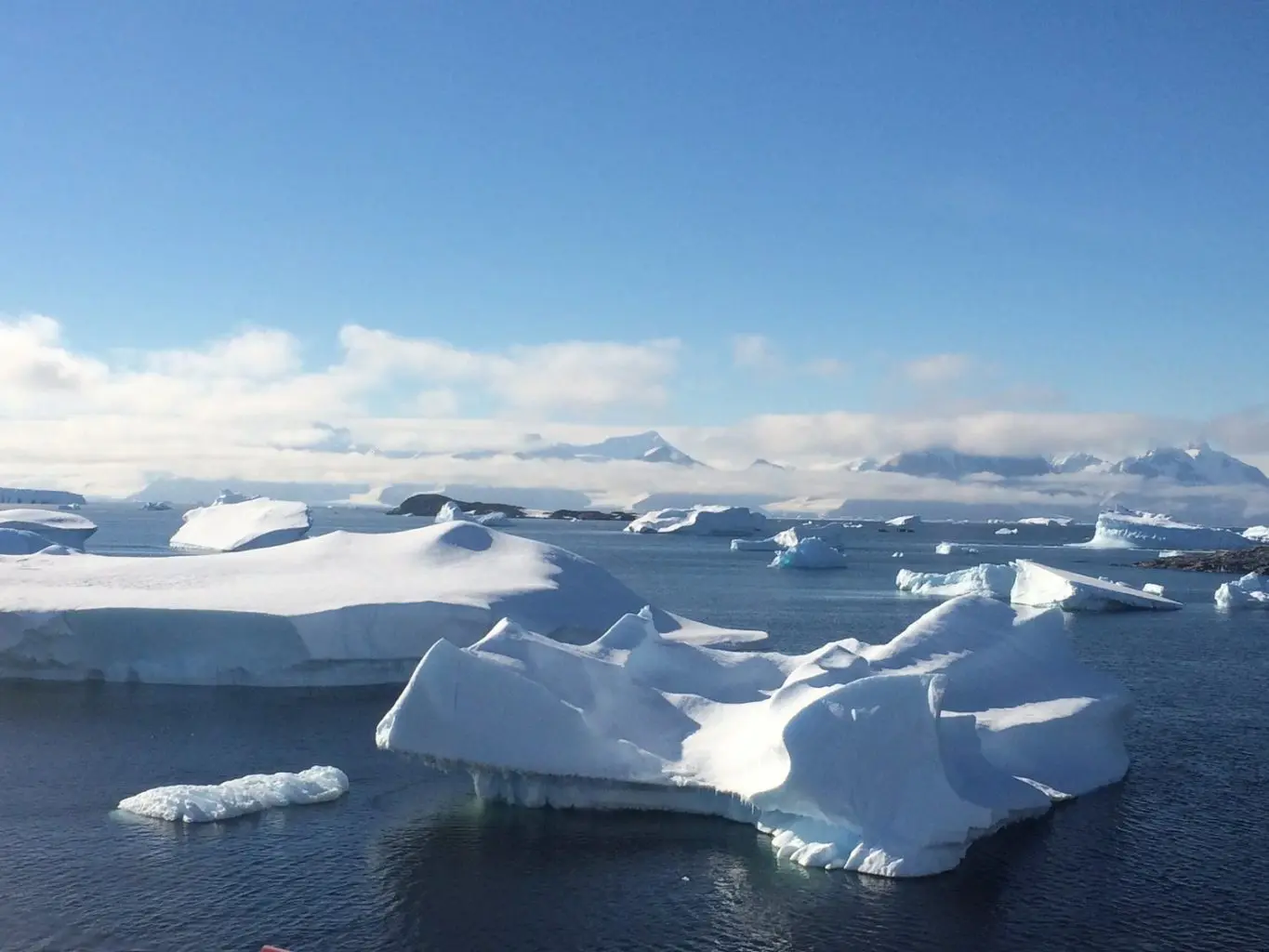
Approximately 98% of Antarctica is covered by ice that is on average, 1.9 km thick. Antarctica is nearly twice the size of Australia, so there are significant implications for sea level rise if this ice were to retreat due to rising global temperatures.
“Antarctica is the frontline of sea level rise,” said Jamin. “Greenland also has an ice sheet that is melting rapidly, but it’s not expected to contribute as much sea level as we believe Antarctica will.”
Luckily for Jamin, these days he gets to conduct his geophysical surveys more comfortably. He spends his time surveying from heated planes, instead of on-ground by snowmobile. From these planes, his small but adept field team has been researching large areas of East Antarctica.
“There are many initiatives to study glaciers in West Antarctica because they’re currently changing the most rapidly,” said Jamin. “But the sea level rise potential of the fastest retreating glacier in West Antarctica, is about 1/6th of what the fastest changing glacier in East Antarctica contains.”
“I’ve flown over this glacier dozens of times, and it’s still hard to wrap my head around how big it is,” Jamin said.
Jamin says that Totten Glacier’s grounding line, the point where a glacier begins to float and form an ‘ice shelf’ instead of resting on the ocean floor, is two kilometres thick.
“To put that into real world units, 6 stacked Eiffel Towers would fit in that,” he said.
And when that grounding line position moves back toward the coastline (creating a larger ice shelf), that increases the amount of ice contributing to sea level, says Jamin. Because ice shelves are exposed to both warming air above and warming ocean below, they are more susceptible to melting due to rising temperatures.
“Many processes that affect that grounding line position will make sea level change for the worse,” said Jamin. “So these environments are obviously really important to understand.”
Collaboration is one of the keys to success
In 2015, Jamin visited the Geosoft (now Seequent – Toronto) office to share his recently published Totten Glacier research. Jamin and his team had received Oasis montaj licenses (for modelling and analysis of geophysical data) through the Geosoft Education Program.
“The Geosoft Education Program was really meaningful to me. I gave that presentation in Toronto as a thank you for that support,” Jamin said. “I used Oasis montaj throughout my whole PhD experience and it’s really become an important part of my daily work and research. I’ve used Oasis montaj to plan survey flights over the majority of the Antarctic continent. I’m really grateful for the support we’ve received.”
Since 2015, Jamin and his team have continued their work in East Antarctica. But this time, his team has been focused on surveying Princess Elizabeth Land.
“This was the largest unknown area of any continent on Earth, before we did this project,” said Jamin. “It was the last frontier of continental exploration really.”
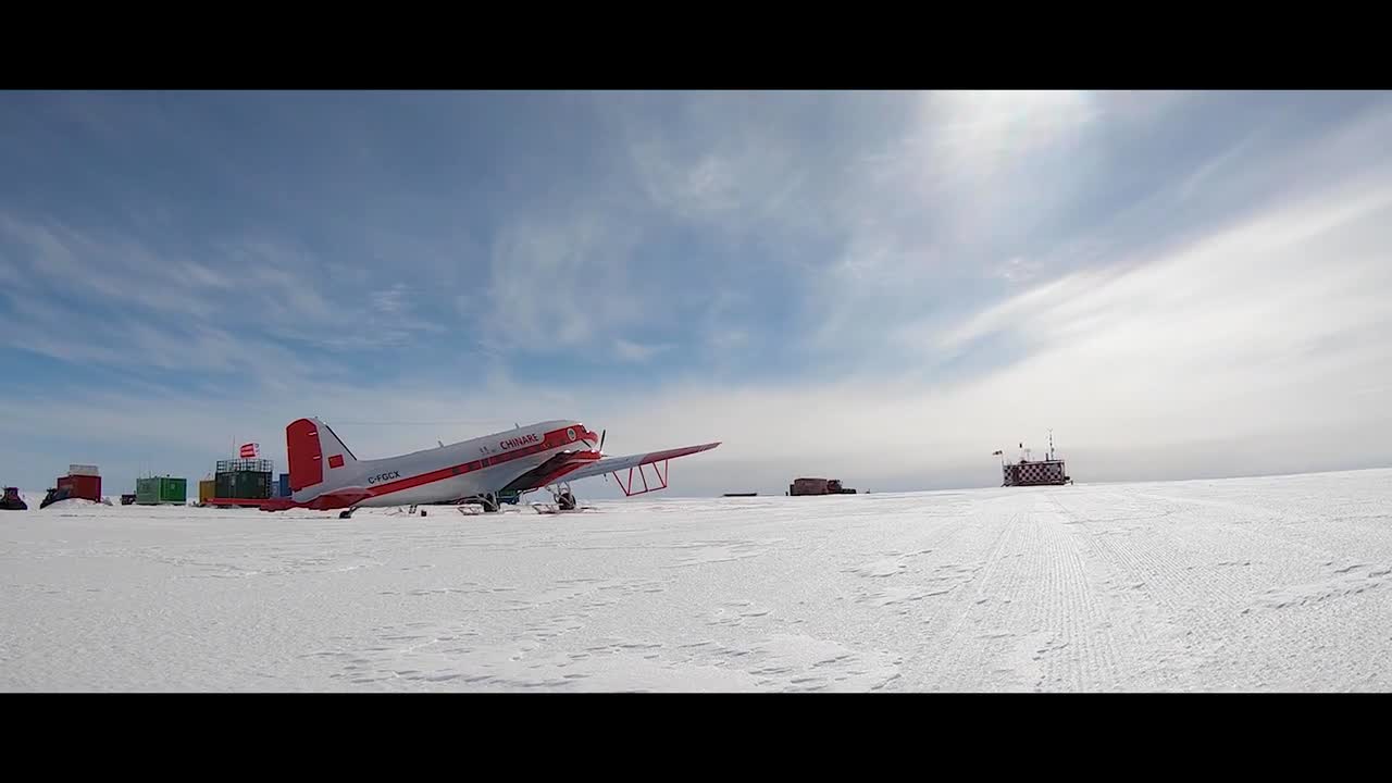
Jamin believes that the collaborative nature of his work is one of the keys to its success. For example, his team has been surveying Princess Elizabeth Land using a BT-67 aircraft provided by the Chinese Antarctic program, while Jamin has been training their team in airborne surveying techniques.
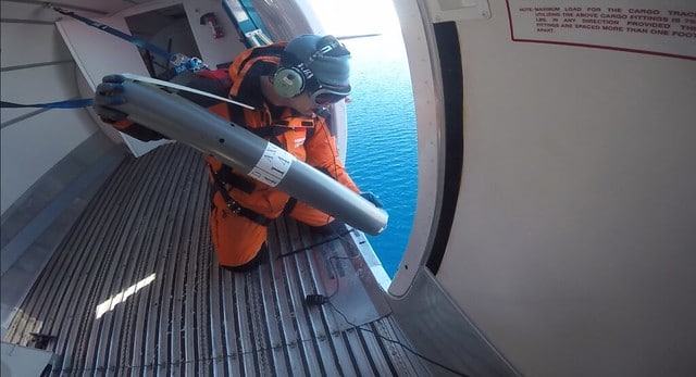
Jamin deploying an Airborne eXpendable Conductivity, Temperature, Depth (AXCTD) sensor, to measure the state of the ocean near one of Antarctica’s largest outlets of sea level potential to the ocean (the Cook Ice Shelf which drains the Wilkes Subglacial Basin)
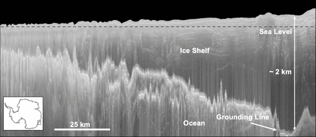
Totten Glacier grounding line
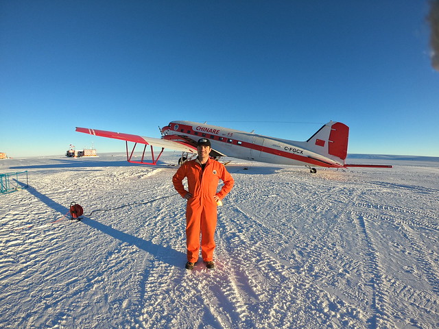
Jamin standing in front of the BT-67 aircraft provided by the Chinese Antarctic program
“We’re like the centre of a wheel here at The University of Texas. We have spokes going to all these national Antarctic programs,” said Jamin. “We run with a small team. But the knowledge accumulated in our group over decades of airborne surveying, has become extremely useful to nations interested in starting their own survey programs.”
In addition to China, the team is also actively working with the Australian, French, Italian, South Korean, and Japanese research programs.
“I’m a huge believer in this international approach to data acquisition,” said Jamin. “No single nation could accomplish the level of survey that we’re doing because of the logistical complexity involved. By working as an international network, we’re able to work with existing infrastructure and spread out the remaining cost burden of fuel, etc. The value of the resulting data is extremely high because it can improve predictions of sea level rise. Beyond that, I believe what we’re doing provides a nice example of what international networks will have to do in the next few hundred years, to mitigate and respond to the impacts of climate change for instance.”
His team’s research about Princess Elizabeth Land will be published in the coming year (stay tuned – we’ll be posting an update once it’s released). In the meantime, Jamin has a busy year ahead. He recently received a Fulbright U.S. Scholar Award to continue to study how quickly coastal ice is melting in East Antarctica. He’ll be spending half of the next academic year in Shanghai, where he hopes to grow two-way Antarctic research programs between China and the US.
He will also be incorporating use of Seequent’s Leapfrog software (for 3D geological modelling and analysis) in his research, through the Academic Research program.
“In the short term I look forward to using the Leapfrog products to create informative visualisations of the glaciers, ice shelves, and subglacial geological environments that we are surveying in Antarctica,” said Jamin. These visualisations will help Jamin share his team’s discoveries with the wider public, which is vital for tackling this global challenge.
“East Antarctica is changing,” said Jamin. “It has a lot of potential to raise sea level, and we can’t continue to ignore it like we have in the past.”
Why Seequent?
Intuitive, collaborative, integrated; Seequent software brings clarity to the complexity of geo-data and decision making.
We enable geo-data to tell a story with software that combines in-depth analysis, 2D and 3D visualisation, and data management. Accessible on desktop and Cloud, Seequent brings together the trusted power of Leapfrog 3D, Geosoft, and GeoStudio software. Our solutions integrate with industry-leading tools and have an open API so that all data and workflows can be considered.
