Water is one of the key resource challenges for every population centre in the world. This is even more true during large-scale humanitarian events, such as the Rohingya refugee crisis, when finding safe, potable water becomes immediate and critical.
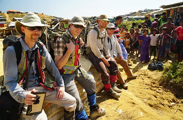
A team of geophysicists from Advisian’s Calgary office went to Bangladesh to help overcome this challenge, and support the Rohingya people.
Colleagues Paul Bauman, Alastair McClymont, Colin Miazga, Eric Johnson and Chris Slater, were commissioned by Oxfam to map aquifers and groundwater in three refugee camps and their surrounding ‘makeshift’ settlements. The aim of the exploration team was to identify drilling locations that would enable access to safe water as rapidly as possible.
The situation
Even before the most recent refugee exodus, which began on 25 August 2017, the Leda and Nayapara refugee camps on the Teknaf Peninsula were trucking water during the five-month dry season of November through March. Long-term, these camps need groundwater resources to carry the 70,000-person refugee population through the dry season.
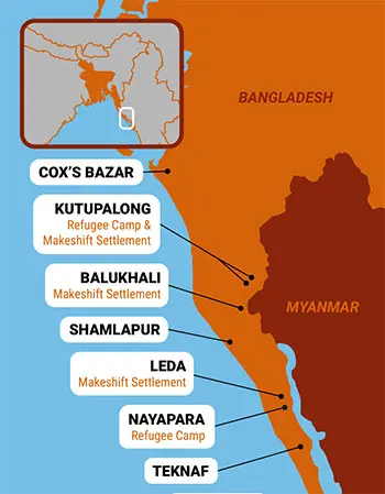
In the 547,000-person Kutupalong-Balukhali Expansion Camp, sufficient water is provided by more than 6,000 shallow boreholes, but about 80% of these are already contaminated by E. coli from overflowing latrines and faecal sludge pits. This camp needs deeper, aquitard protected, high-yielding aquifers to supply a sustainable source of clean drinking water through both the wet and dry seasons.
Bangladesh currently hosts over 1,000,000 Rohingya refugees who have escaped human rights abuses in neighbouring Myanmar. Around 655,000 Rohingya have fled Myanmar in this latest period of unrest which began on August 25. Most crossed into South-eastern Bangladesh, either crossing by raft or boat the Naf River and estuary to the southern Teknaf Peninsula, or walking through the jungle and hills to the upper Teknaf peninsula area, around Cox’s Bazar. These two areas are where the team’s efforts were concentrated.
International humanitarian agencies such as the United Nations Refugee Agency (UNHCR), International Organization for Migration (IOM), United Nations Children’s Fund (UNICEF), and many others coordinate with the Bangladesh government to support expanding refugee settlements, while also trying to minimise resource pressure on existing communities. This means providing emergency relief in the form of aid, as well as implementing infrastructure and processes that can be rapidly scaled to meet demands.
The team’s work
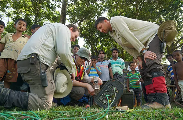
In the Kutupalong-Balukhali Expansion Camp, by far the largest settlement (approx. 547,000 people), Paul’s team created 3D models in Leapfrog Geo using data from electrical resistivity tomography (ERT), existing well data and digital elevation models provided by drones flown by the geophysics team. ERT data collection involved laying long stretches of cable (up to 1200m) on the ground surface, and inserting evenly spaced electrodes into the earth to send current and measure voltages, and then inverting for resistivities. While the rugged terrain, lack of proper sanitation, and incredible density of people made data collection challenging, the team confirmed this was the most effective technique for these circumstances.
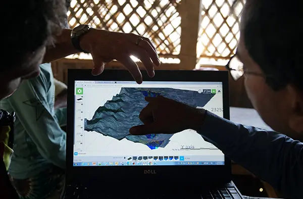
New sections of ERT data were collected every day, then the models were updated the very same evening. During the regular briefings with humanitarian agencies, government, and working groups, the team presented the models using View. Being browser-based, View was ideal for sharing updated models quickly with the largely non-technical audiences.
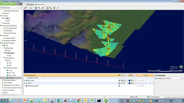
The larger sandstone body appearing on the east ends of the ERT lines was observed to tie into some know producing wells and identifies an aquifer. Sustainability is unknown until pumping tests are completed.
The results
UNHCR has found View a particularly effective tool to clarify and communicate findings to their infrastructure teams. Bauman said he found View “outstandingly useful” and noted that 3D modelling had become “UNHCR’s lingua franca of looking at data.” He drew the analogy of entering a hospital with 100 surgeons and 600,000 patients, and introducing X-Rays and Ultrasound for the first time. The insights provided by these technologies revolutionised medicine.
The role of Seequent modelling and viewing software in this situation is minor compared to the contributions made by the people and work teams on the ground. Their efforts will guide the installation of hundreds of water-supply wells for the refugees, and data from those wells will be made available in View for monitoring.
Many hundreds of humanitarian and crisis agencies operate in Bangladesh and around the world. For more detailed information on efforts in Bangladesh, see United Nations Refugee Agency (UNHCR), United Nations Office for the Coordination of Humanitarian Affairs (OCHA) International Organization for Migration (IOM), United Nations Children’s Fund (UNICEF) and Oxfam International.
Special thanks to Paul Bauman and Alistair McClymont for the story, the pictures, and your efforts on the ground in Bangladesh.