


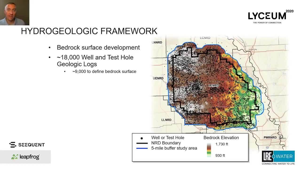
This presentation discusses the development of a hydrogeologic framework for the Lower Elkhorn Natural Resources District, an area in Nebraska covering around 4,000 square miles.
The framework incorporates approximately 5,700 flight miles of airborne electromagnetic (AEM) resistivity data and depth-to-bedrock data from well and test hole geologic logs. Learn how this project used Leapfrog’s powerful interpolation of over 7 million AEM data intervals and its ability to construct and export a numerical groundwater flow model grid.
Overview
Speakers
Mike Plante
Lead Hydrogeologist – LRE Water
Duration
15 min
See more on demand videos
VideosFind out more about Seequent's environmental solutions
Learn moreVideo Transcript
transcript here